Field Guide / Navigation
How to use a compass, read a topographic map, understand coordinates and declination, get the most from a GPS or phone, and find your way with simple techniques. Search or filter by type and how you get outdoors, and use the diagrams to see how each idea works.
Navigation is a skill, so practice it close to home before you rely on it far from help. Values such as magnetic declination change over time and place, so check a current source. Carry a paper map and compass even if you use a GPS, tell someone your plan, and call 911 if you are in real trouble.
27 entries
 Compass
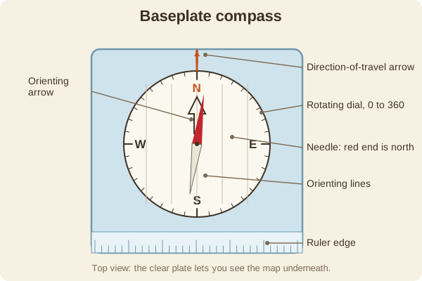
A compass on a clear plastic base with a rotating dial and a ruler edge. It is the best everyday choice for working with a map.
Clear base plate, rotating dial, map rulers
 Compass
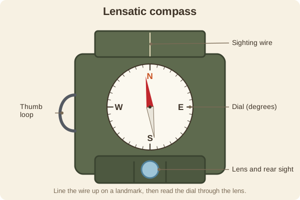
A rugged folding compass with a sighting wire and a lens. It is built to take a precise bearing to a far-off landmark.
Sighting wire and lens for precise bearings
 Compass
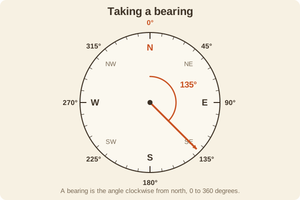
A bearing is a direction measured in degrees clockwise from north. Taking one from the map and following it is the core compass skill.
0 to 360 degrees, clockwise from north
 Compass
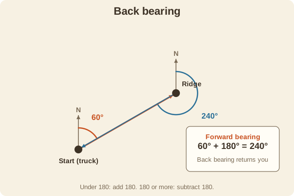
The back bearing is the opposite direction of a bearing. It points back along the way you came, and it is the bearing used in triangulation.
Add or subtract 180 degrees
 Compass
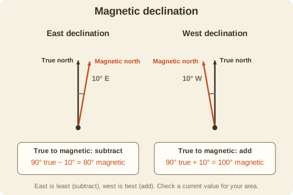
Declination is the angle between true north (the geographic pole) and magnetic north (where a compass needle points). It changes with place and slowly over the years.
East: subtract. West: add (true to magnetic)
 Compass
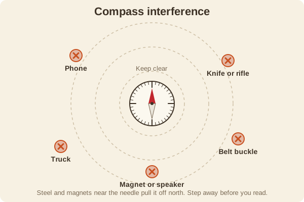
Steel, magnets, and electronics near a compass pull the needle and give a false direction. Keep it clear when you take a reading.
Keep steel and electronics a few feet away
 Maps & Grids
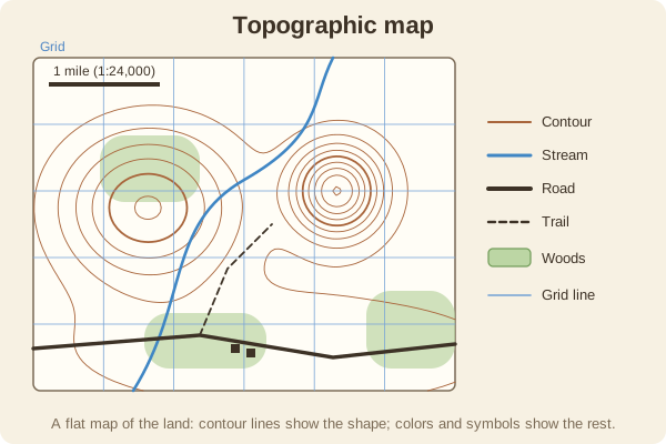
A map that shows the shape of the land with contour lines, along with trails, roads, water, and woods. It is the main tool for planning and following a route.
Shows terrain with contour lines
 Maps & Grids
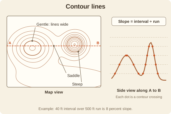
Each contour line joins points of the same elevation. How close the lines are shows how steep the ground is, and their shapes show hills, valleys, and ridges.
Close lines mean steep; wide lines mean gentle
 Maps & Grids
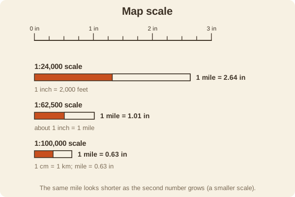
The scale tells you how map distance relates to ground distance. A bigger number after the colon means a smaller-looking, less detailed map.
1:24,000 means 1 inch = 2,000 feet
 Maps & Grids
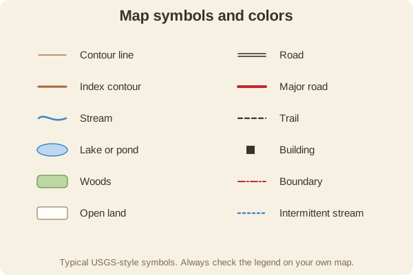
Colors and small symbols on a map stand for roads, water, woods, buildings, and trails. The legend explains the ones on your sheet.
Blue is water, green is woods, brown is contours
 Maps & Grids
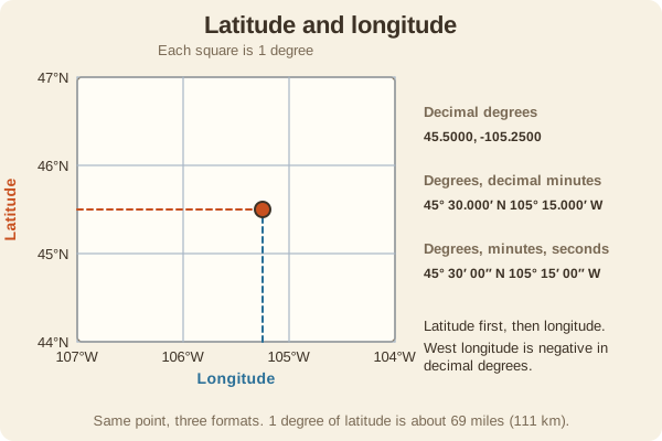
A coordinate system that gives every place on Earth two numbers: latitude (north or south of the equator) and longitude (east or west of the prime meridian).
Latitude first, then longitude
 Maps & Grids
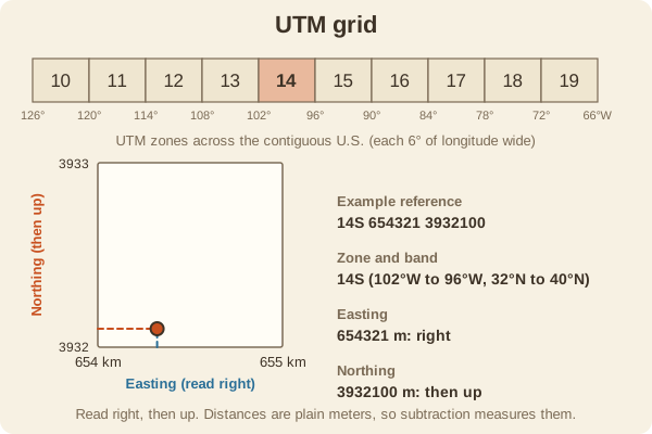
A grid laid over a map in meters. You read a position as an easting (how far east) and a northing (how far north), which makes measuring easy.
Read right, then up, in meters
 Maps & Grids
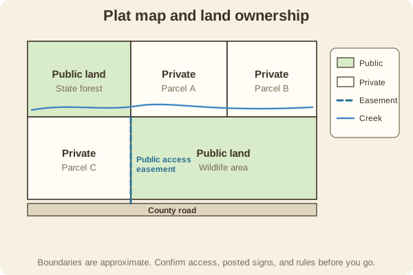
Plat and ownership maps show who owns each parcel and where public land begins. They matter for hunters, hikers, and anglers because a topo map usually does not show it.
Shows who owns what, so you stay legal
 GPS & Devices
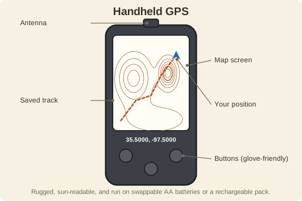
A rugged, battery-powered receiver that shows your position on a map. It is built for weather, long battery life, and use with gloves.
Tough, long battery life, works without cell service
 GPS & Devices
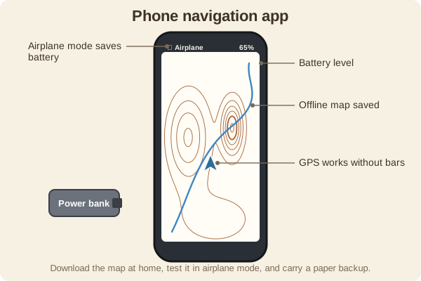
Smartphone apps can show your location on a topo map even with no cell service, as long as you download the map first. Battery and weather are the weak points.
Download maps first; the GPS works without bars
 GPS & Devices
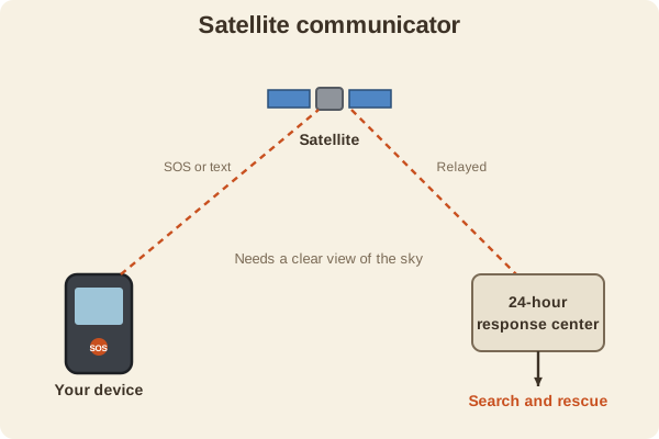
A small device that sends texts and an SOS call through satellites when you have no cell service. It is for emergencies and for staying in touch off the grid.
SOS and texts from beyond cell coverage
 GPS & Devices
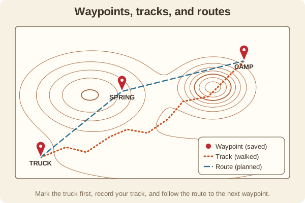
A waypoint is a saved spot, a track is the trail you actually walked, and a route is a planned line to follow. Together they let you find your way back and share a trip.
Save a waypoint at the truck before you leave
 GPS & Devices
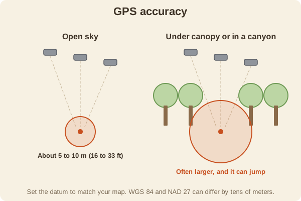
A consumer GPS is usually good to within a few meters in the open, but trees, canyons, and the wrong datum can make it worse. Battery habits decide how long it lasts.
About 5 to 10 meters in open sky
 Techniques
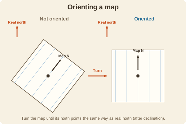
To orient a map is to turn it so the north on the map points to north on the ground. Then every feature on the map lines up with what you see.
Turn the map until it matches the ground
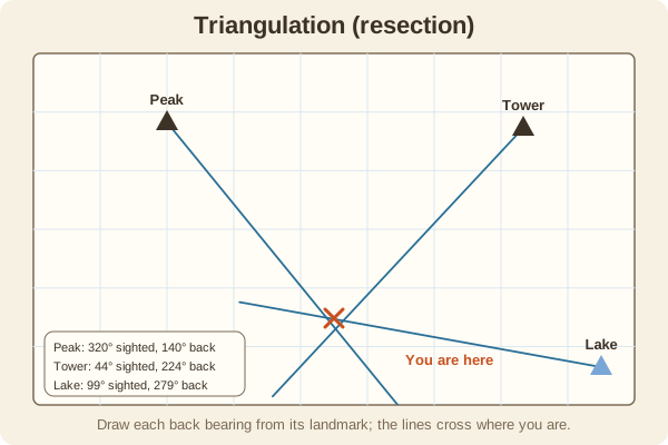 Techniques
Sight two or three known landmarks with your compass, convert the bearings, and draw lines on the map. Where they cross is roughly where you are.
Two lines cross at your position; three are better
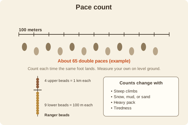 Techniques
Count your steps to measure how far you have walked. Combined with a compass bearing, it lets you navigate with no landmarks at all.
Learn your double paces per 100 meters
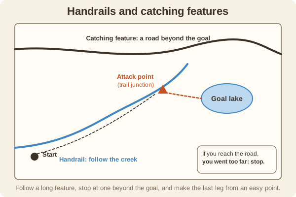 Techniques
A handrail is a long feature, such as a creek or fence, that you follow. A catching feature is one beyond your goal that tells you if you went too far.
Follow a handrail; stop at a catching feature
 Techniques
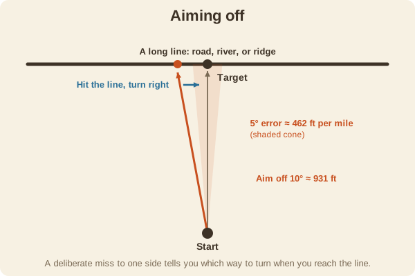
When your target sits on a long line such as a road or river, aim a little to one side on purpose. Then you know which way to turn when you hit the line.
Aim to one side so you know which way to turn
 Techniques
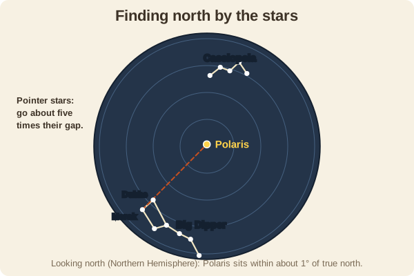
In the Northern Hemisphere, Polaris sits almost exactly above true north. You can find it from the Big Dipper's pointer stars or from Cassiopeia.
Polaris is within about 1 degree of true north
 Techniques
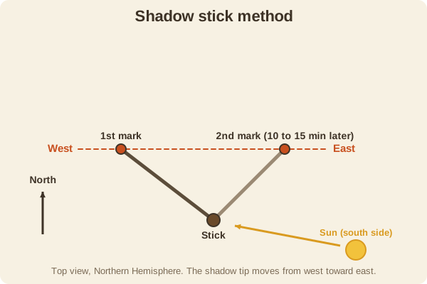
Mark the tip of a stick's shadow twice, about 15 minutes apart. The line between the marks runs roughly west to east.
First mark is west, second mark is east
 Techniques
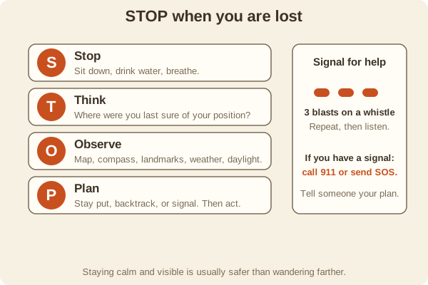
If you think you are lost, Stop, Think, Observe, and Plan. Most people who stay calm and stay put are found sooner than those who keep wandering.
Stop, Think, Observe, Plan
 Techniques
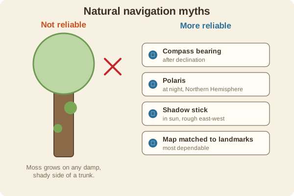
Moss, tree shape, and the like are not dependable direction finders. Use a compass, the Sun, or Polaris, and treat natural signs as weak hints.
Moss does not reliably grow on the north side